


By Chris Austin [The following article first appeared in Maven’s Notebook]
The recent succession of atmospheric rivers has spurred support for groundwater recharge, creating a wave of momentum for moving recharge projects forward. Earlier this year, Governor Gavin Newsom signed an executive order to enable local water agencies that are water users to capture water from the latest round of storms to recharge state groundwater supplies. At the April meeting of the California Water Commission, a panel discussed current groundwater recharge activities happening in the Central Valley, and their associated opportunities and challenges.
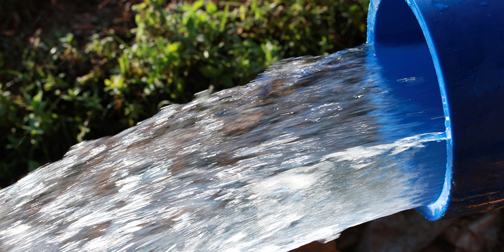
Winter 2022/23 Putting the “FLOOD” in Flood-MAR
Jenny Marr, supervising engineer with DWR’s Flood MAR program, set the stage by providing an overview of managed aquifer recharge (MAR) using high flows.
 This year’s exceptional precipitation has put the ‘flood’ in Flood-MAR, and with groundwater agencies now working to implement their plans, there is heightened interest in using floodwaters to replenish overdrafted groundwater basins.
Flood MAR is an integrated and voluntary resource management strategy that uses floodwaters for managed aquifer recharge of agricultural lands, working landscapes, and managed natural lands, such as refuges, floodplains, and flood bypasses. It can be implemented at many scales, from landowners diverting onto their fields to regional agencies using large recharge basins. Flood MAR’s benefits include water supply, flood risk reduction, drought preparedness, ecosystem enhancement, subsidence mitigation, working landscape preservation, and water quality improvement.
Challenges include:
- Water available for recharge: Flood MAR mostly uses infrequent high flows, and rights to use that water for recharge require a permit from the State Water Board.
- The capacity of diversion and conveyance facilities: Facilities are often insufficient for the magnitude of these infrequent high flows, and building bigger infrastructure is not always cost-effective.
- Land use: the ability to take water depends on land use, as the timing and depth of flooding may impact crop yields, water quality, and habitat suitability.

 The slide summarizes the type of water rights permits and their suggested use. The streamlined standard permit specifically targets groundwater sustainability agencies or other local public agencies looking to capture high flows for groundwater recharge.
Ms. Marr explained that water rights are challenging to obtain because the water rights system has been in place for 100 years, and unfortunately, Flood MAR projects are at the back of the line, so it’s the less reliable or less frequent high flows that are left.
“Since the release of the governor’s water supply strategy last summer, DWR has been providing technical assistance to local agencies interested in obtaining temporary water rights for implementing pilot projects using high flows for recharge,” she said. “What we’ve learned isn’t surprising – water rights are complicated. They’re resource-intensive and time-consuming to apply for. But they also protect a finite resource, existing legal water users, and the environment. So if you have an existing water right, you’re thankful for all these things. But if you want a new water right, the challenges can seem daunting. But there are newer pathways to help the process become a little easier, less resource-intensive, and less time-consuming.”
In early 2023, Governor Gavin Newsom issued an executive order to simplify diversions for Flood MAR efforts. The order allowed water users to divert floodwaters and take intentional actions to maximize groundwater recharge, which would normally require a water right. The order provided relief from the water right process and additional regulatory relief from CEQA and the lake and stream bed alteration program for diversions from March through June 1.
Agencies and landowners looking to implement Flood MAR projects next winter should be applying for water rights soon. Ms. Marr recommended they take advantage of temporary permit options, which are cheaper, quicker to develop, and issue. To further expedite the water rights process, local agencies should look to the State Water Board guidance for simplified water availability analyses, pursue umbrella permits at the district scale, and use current CEQA exemptions for projects that divert high flows for groundwater recharge.
YOLO COUNTY FLOOD CONTROL AND WATER CONSERVATION DISTRICT
 The Yolo County Flood Control and Water Conservation District is a special independent irrigation district created by the legislature in 1951. The area in yellow is the 200,000-acre service area in western Yolo County; the District’s operational area extends northwest and is shown in blue.
Crops include almonds, hay, oats, wheat, barley, tomatoes, olives, wine grapes, rice, sunflower seeds, corn, and walnuts.
 The District manages and operates Cache Creek Dam at Clear Lake and Indian Valley Reservoir. Irrigation and stormwater flows are released from those facilities and travel down Cache Creek to the Capay Diversion Dam in Yolo County, where it is then diverted into the District’s160-mile unlined canal system.
“The District’s policy has been and will continue to be to have an earthen canal system as this has provided a significant benefit to the community at large,” said General Manager Kristin Sicke. “During the irrigation season, on average, we lose about 25% of our surface water deliveries to groundwater. And in years like last year when we had no water to deliver, the impact on domestic wells was very evident because we had domestic wells running dry. So it’s important to continue to offer the conjunctive use and management of our facilities.”
 The District has an extensive groundwater monitoring system, as shown on the map. The blue dots are the periodic monitoring wells measured every spring and fall. The red dots are continuous monitoring wells connected to a SCADA (System Supervisory Control and Data Acquisition) system that provides real-time depth to water measurements. The yellow dots are the SGMA representative wells.
The slide below shows the average hydrograph for the District, spanning from 1975 to 2022. The higher measurements are the spring measurements, and the lower measurements are the fall measurements taken after the irrigation season. The chart shows that groundwater levels recover in wet years, largely due to the District’s surface water supply available for recharging. At the time of the presentation, the numbers weren’t in for spring of 2023, but Ms. Sicke said they are seeing a good recovery.
 The District has also made significant investments in the SCADA system for surface water monitoring control. There are 72 control sites for dam flow, canal level, and flow control. These investments have enabled them to have consistent level and flow control in the canal system, which reduces spilling and shortages. The system also reduces the time staff has to drive around the canal system and makes it easy to use in the winter months for groundwater recharge.
Groundwater recharge history
 One of the challenges with diverting floodwaters is that the water can be very sediment-laden, especially at the peak of a storm, as the sediment plugs up the system and hinders recharge. So the water is diverted after the peak of the storm.
The amount of water diverted for recharge during the winter is shown on the chart. The most diverted under the permit was 11,000 acre-feet in 2016, although the numbers weren’t in at the time for 2023.
The permit requires that the Delta be in excess and instream flows maintained in Cache Creek to a certain point downstream at the Yolo Gauge. The diversion season is from January 1 to April 30 because of considerations of downstream water rights holders.
The expense of obtaining water rights
“We’ve successfully been able to use or divert flows for four years out of the eight years that we’ve applied with the State Water Board,” Ms. Sicke said. “One thing we’ve appreciated about the temporary permitting process is the cost. It’s a very cheap cost compared with the long-term permit.”
 The slide shows the cost of obtaining a permanent water right vs. a temporary permit. The chart shows that a permanent water right can cost $500,000 or more in fees, while a temporary permit costs just $6,000-$10,000.
“Running a not-for-profit irrigation district that is barely getting by, we don’t have half a million dollars to request a permit. So we’ve really appreciated the flexibility of the temporary permit fees. The process is very streamlined and much simpler and easier to work through; however, we have been told by State Water Board staff that we can’t do it forever because there are water code restrictions on the temporary permit aspect. So they have requested that we start proceeding with the long-term process. We’ve requested grant funding for that half a million dollars. So I’m hopeful that we will be able to go that route. But that has been a significant impediment to this point.”
“We’d really like to work with the State Water Board to find a middle road there that could be a hybrid between the temporary and long-term permits and maybe not require such a significant upfront application cost.”
Ms. Sicke acknowledged that Water Board staff recognize there isn’t a ‘one size fits all’ solution; each watershed is unique. The Cache Creek system is flashy; storms come and go quickly, and the flows drop off rapidly. So having sustained flows above a flooding stage as a criterion doesn’t work for this watershed; the governor’s executive order this year was not useful to them.


TRIANGLE T WATER DISTRICT
Sarah Woolf, a water management consultant and the president of Water Wise, then discussed two recharge projects she has been working on in the San Joaquin Valley, the first being Triangle T Water District.
 In 2012, the Triangle T Water District had some of the highest subsidence rates. The impacts from the subsidence extended beyond the District to the existing gravity flow infrastructure of the Exchange Contractors on the other side of the San Joaquin River. A study determined there was a 10,000 acre-foot overdraft occurring on about 25,000 acres of land.
“It was a very significant overdraft in an area that was somewhat small but happening quickly from a change in cropping patterns,” she said. “And the District has no surface water supply and is 100% reliant upon groundwater.”
Immediately after the study, 500 acres were fallowed, a water district was formed to obtain surface water supplies, and a distribution system was put in place to deliver water into the area. A siphon pipeline was completed right before the major flooding events in 2017, and that year alone, 15,000 acre-feet was delivered to over 15,000 acres. The District also started transitioning from the deep wells, which were the cause of subsidence, to shallower wells because the surface water supplies were replenishing the shallow aquifer.
They also realized that one pipeline would constrain how much surface water could be brought into the area. Without any contracts for surface supplies, they needed to find ways to do as much recharge as possible when a flood was occurring.
The Triangle T District is adjacent to the Chowchilla Eastside Bypass, a flood diversion bypass for the San Joaquin River when high flows are being released from Friant Dam to protect the communities of Mendota and Firebaugh. A local levee district maintains the bypass, and they supported diverting from the bypass for additional flood protection because the bypass had suffered from subsidence and capacity had shrunk considerably.
So in conjunction with the levee district, they analyzed the pursuit of an appropriative water right so that the landowners adjacent to the bypass could get a groundwater credit for recharging water from the bypass when available. Understanding that an application for a permanent water right was expensive yet critical for survival, a group of landowners submitted an application in 2019 along with over $600,000 in application fees.
The environmental review process for the water rights permit has not yet begun, as the State Water Board requested additional information, including a water availability analysis. “They want us to do a water availability analysis from the headworks of the San Joaquin River to the Delta, and we haven’t quite figured out how we would tackle that. We’re in discussions with the State Board on that … because that is a really big endeavor that would benefit all appropriative water rights applicants along the San Joaquin River.”
 In the meantime, the District has been applying for temporary 180-day permits, with three approved since 2019. However, they have not been able to utilize those temporary permits because the conditions placed on them are not something the District can act on quickly should a flood event occur. Those conditions include installing fish screens in the flood bypass and monitoring to comply with the measurement requirements of SB-88, which are made difficult due to the use use of temporary equipment. It’s also hard to preselect the months for diverting water, as that can vary dramatically from year to year.
Landowners were able to take advantage of the executive order, although they won’t receive any groundwater credits. “In a year like this, we’re able to use that water out of the bypass for irrigation and recharge, and both of those activities are things we can obviously only do when that supply is there, but we have limited opportunities to do it,” said Ms. Woolf. So maximizing when it’s available to the greatest degree possible is very important. And we do have many permanent recharge facilities, ponds in the area that take this water when it’s available, as well as putting them directly into irrigation systems on existing farms for direct irrigation.”
ARROYO PASAJERO MUTUAL WATER COMPANY AND THE CITY OF HURON
Sarah Woolf then discussed the second project for the Arroyo Pasajero Mutual Water Company and the City of Huron. The Arroyo Pasajero Creek flows through the city; it is very flashy and often floods the city, causing major damage. Several years ago, DWR built a detention basin to capture the water from the creek to relieve some of the flooding. Farmers with land adjacent to the basin can also put water on their fields when the basin is full, so they have applied for a standard appropriative water rights application. Ms. Woolf noted that their application fee was significantly lower because the amount of water being diverted was less, but nonetheless, it was a very expensive application.
 The City of Huron, a severely disadvantaged community in Fresno County, receives Central Valley Project water. However, those supplies were limited to health and safety during the drought, so the city drilled a groundwater well to acquire more supplies.
The project has applied for three temporary 180-day permits that have all been approved and utilized. However, there is opposition from the local GSA, which has included the natural recharge from the creek in their GSP; the GSA believes the diversion of water does not enhance the recharge.
“We have studies that show it does,” she said. “Nonetheless, there is a dispute between the GSA and the landowners in the city. Because of that dispute, I think the State Board has struggled with issuing the standard permit for this project. So we’ve been talking about entering into a five-year streamlined application that allows the State Board to decide on that conflict.”
TULARE IRRIGATION DISTRICT
 Aaron Fukuda, general manager of the Tulare Irrigation District, discussed their efforts to increase groundwater recharge.
The Kaweah GSA is a 141,000-acre critically over drafted subbasin. The Tulare Irrigation District (TID) is a 65,000-acre irrigation district located within the Mid-Kaweah GSA. Corn, wheat, alfalfa, walnuts, almonds, and pistachios are grown within TID.
TID operates 300 miles of earthen canals, which they have opted not to line because of the recharge benefits. They operate and maintain 1,300 acres of recharge basins, shown in purple on the map.
TID’s surface water supply is comprised of pre-1914 water rights on the Kaweah River and a Bureau of Reclamation contract for 30,000 acre-feet of Class 1 water. They also have 141,000 acre-feet of Class 2 water; this year, the allocation is 70% of that 141,000 acre-feet.
Last year, TID was at a low point. Groundwater levels were at an all-time low, and the District was close to insolvency because there were no irrigation runs for three years, so there was no revenue. The Mid Kaweah GSA’s groundwater sustainability plan was determined to be incomplete, so revisions had to be made within 180 days. TID also had to go through a Prop 218 four times to raise rates, mainly for SGMA compliance, groundwater allocation, and cutback programs.
The water accounting framework underlies their approach to SGMA by defining the methodology to assign groundwater credits as water enters the basin. The source water is divided into three buckets: native, foreign, and salvage supplies, which are assigned to folks accordingly.

 In 2021, as wells began to go dry, an emergency ordinance was developed, largely driven by the landowners themselves, to set pumping limits. Groundwater-dependent users are allocated 2.5 acre-feet per acre, measured as evapotranspiration. Those with surface water rights are allocated additional water according to how much they recharge. There is a mitigation tier where growers pay $260 an acre-foot if they exceed their allocation which acts as a buffer as the program starts up. The penalty tier costs users $500 per acre-foot and loss of that amount from next year’s allocation.
“That system went into place last year,” said Mr. Fukuda. “For demand management, it was a great tool. We cut back on being or evapotranspiration by 13% compared to the prior year, which was about 20,000 acre-feet across our District.”
 Key to their success is an online tool that tracks allocation and evapotranspiration usage, so growers can see how much water they have available; it also tracks recharge credits that growers can use for future groundwater pumping. So when the atmospheric rivers showed up in January, the District was ready. In January alone, 36,000 acre-feet was diverted, with 80-90% infiltrating into the aquifer. Over January, February, and March, about 103,000 acre-feet was diverted, with about 95,000 acre-feet now in the groundwater system.
The logistics issues are significant, Mr. Fukuda said. “Getting out to the turnouts was a difficult venture; the measurement was difficult. And simply put, there was just so much water out there. It was funny because everybody was miserable. It was cold and wet. Yet all of our district tenders were wearing smiles on their face. Some of our ditch tenders had been working for our irrigation district and had never run water before, so they were happy to be doing their job. But it was pretty difficult.”
Mr. Fukuda then gave his closing thoughts. “We are a conjunctive use irrigation district, so we have a history of recharge. But we doubled our recharge efforts just by making some difficult decisions last year in implementing our emergency ordinance. Allocation and limits were not welcomed. But they’re a valuable tool and incentive. And the growers ultimately become the users of those tools. And they can ensure a good business plan for themselves. Today in our District, the common saying is that instead of only one recharge agent (TID) in the District, we now have 201. So we went from effective to very effective.”
Mr. Fukuda closed by noting that SGMA is a two-track program. “That means that you have your GSP and you have the implementation, and folks shouldn’t lose sight of that. You’ve got to keep your eye on the implementation, or else you spend too much time and money on your GSP. And you won’t have anything left for the actual programs to get the sustainability.”
Challenges To Implementation
During the discussion period, Commissioner Kimberly Gallagher asked what the barriers were for landowners and what the state could do to encourage this.
“With the two projects I work on, there’s tangible physical benefit from moving this water onto the farm ground and improving the recharge and the viability of those groundwater wells when they have to be used,” said Sarah Woolf. “We would not be going after these appropriative water rights permits if it were not for the need for a SGMA groundwater credits. So if there were a way to take flood flows and receive a beneficial use and a groundwater credit for that activity, without a permit, we would be doing that.”
“I think a lot of the tension that the State Board staff is having to grapple with is the water availability analysis and considering who are we impacting and if we could possibly be harming those prior to us,” she continued. “That’s really not the intention of these Flood-MAR activities. It’s not to impede on anyone’s existing right – it’s to take excess flows. And so finding that appropriate pathway to take this water and get a beneficial use for it, when it’s in a flood condition is one of the main hurdles that I believe the State Board has been struggling with.”
Mr. Fukuda said the reason they were successful was by giving growers credit for the groundwater recharge—also, the fear of being left out. Everybody started ordering water when they saw their neighbors doing it. “So once you get growers engaged in the process and get the credits for it, I think they become incentivized to be a part of it.”
“Some of the impediments are large, and some of them are small, but Flood MAR doesn’t happen without willing landowners,” said Ms. Marr. “Landowner engagement is extremely important. And doing field demonstrations, having pilot projects, and people talking about their experience is really important because neighbors talking to neighbors about their positive experience, being able to recharge, and maybe getting some credit for it – these are the kinds of things that snowball.”

