


 The Lower Tule River ID/Pixley ID Groundwater Planning Commission meeting was held at Lower Tule River Irrigation District headquarters in Tipton on Tuesday, December 18, 2018. This group has been meeting before SGMA was enacted. LTRID’s General Manager Eric Limas called the meeting at 10:00 am and we started with self-introductions. There were about 30-folks in the room. There are a couple of new board members on both LTRID and Pixley ID’s boards in attendance.
Friant Kern Canal Subsidence
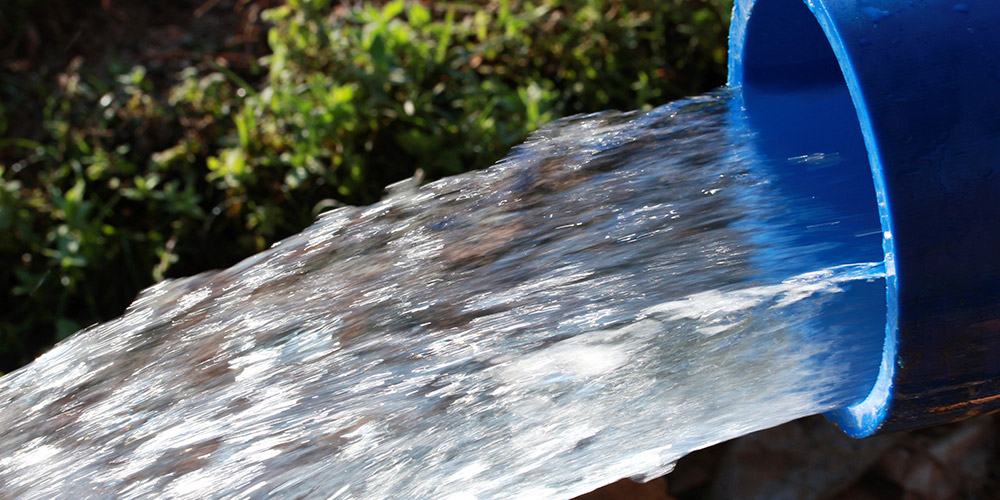
Four Creeks Engineering’s Dave DeGroot told the board each of the six Groundwater Sustainability Agencies in the Tule River Sub Basin will have its GSP in the overall cooperating agreement. Tom Harder is the hydrogeologist for this sub  basin. He has a computer model that will isolate each GSA from the scenario impacting the subsidence on the Friant Kern Canal. The amount of subsidence in the Tule River Sub Basin is where the FKC has the subsidence. Harter is trying to determine the specific area most responsible for the subsidence. The collapsing stretch is in White Area, un-districted land. As DeGroot said before anyone points fingers and assigns blame it would be good to know what the problem is. The minimum cost to fix the FKC at the impacted area is estimated to be $300 million. I’m not sure what the ultimate price will be to fully restore the canal’s capacity. Limas said fixing the FKC is the most important issue facing the area. Dan Vink, Executive Director of the South Valley Water Association said as soon as it was evident Prop Three had failed a team was put together to identify all the grants available in Sacramento and Washington DC.
DeGroot said the Prop One funding of $1.5 million has come through and will pay for all the evapotranspiration records from the Cal Poly satellite data covering the sub basin. DWR is OK with this. There is more funding available for implementation after the study money has been spent. The sub basin scores very well for grants as it is ground zero for many of the criteria such as disadvantaged communities and such. They have a good story to tell.
Transitional Pumping
Transitional pumping is the amount of pumping allowed under the sub basin’s Groundwater Sustainability Plan over the 20-year implementation. Limas had asked at an earlier meeting if transitional pumping credits could be transferred and how long should credits roll forward? He said the growers have said the pumping credits need to stay with the land and the roll over  should last for five-year periods. He said the growers have said the rates should be tiered and a $1,000 per a/f penalty and a reduction of 1.5 a/f allocation for each acre foot pumped over the transitional limits. It’s harsh but it has to be a clear choice between over pumping and trying to make that extra profit or achieving the goal of sustainability. The revenue from this will go towards projects to improve the groundwater situation. Grower Vincent Sola asked for a scenario involving almonds and a double crop showing how transitional pumping will be handled. Staff said that is doable at next month’s meeting or today’s meeting could go late into the night as those spreadsheets are drawn up. A grower asked why the $1,000 per a/f was chosen and why not $10,000 a/f. He said he felt it was arbitrary. Limas reminded him it is a penalty price after all the other available water has been pumped. You’ll be able to pump amounts up to the safe yield, tiered but available. This is pumping beyond that has to be punitive and disincentivizing or the neighbors will suffer as they comply yet have supplies pumped out from under them. Lower Tule grower Mike Faria pointed out this can be adjusted over the course of 20-years so the chaos can be whittled away. There were other comments about the concern of neighboring sub basins not complying and harming each other. Delano Earlimart ID’s Dale Brogan said the key will be talking with each other. DEID is downstream of the subsidence on the FKC so there is a great deal of desire to get the subsidence under control. There were three scenario for the tiered pumping amounts based on five-year increments along SGMA lines that varied from 2 a/f to .25 a/f.
Some one asked if there is any hope the state will allow some time for much expected chaos to unfold and settle. Vink  said the state is indicating it will not give any extensions, rather just the opposite. But, there is still the flexibility to alter the plans throughout the course of SGMA. DeGroot said once Harder comes up with some more modeling these figures can be determined on a farm by farm basis to show the best possible results for the area. I asked if there were any crops in the area that could be “stumped”. During the drought I read about avocado growers in Southern California cutting back their trees – stumping them – they can’t produce but they can stay alive on a minimal amount of water. No one knew of any case like this. Cutting back almonds or pistachios or not getting part of your dairy herd breed annually – no ideas were forthcoming.
Currently groundwater credits can be moved within a GSA in the Tule River Sub Basin. The cooperative agreement between the GSAs may well allow transfers between GSAs within the basin. There is also a break down of sources: surface water, basin-wide safe yield, district allocated groundwater credits, landowner developed credits and transitional pumping credits. Hopefully this will all amount to enough water to keep going. However, there is still a lot of thought needed to set the pricing on these different types of water. Setting anyone of them too high or too low will dramatically impact which water is used. Rain water will count differently for dairies and differing crop types. The same as developed land like urban and industrial. Brogan said each drop of rain should count to the credit of the GSA it lands in – whether or not the crop used it. He also said the different clay layers will have some impact on credits due to differing recharge characteristics. Dry land wheat is a case in point. There are times depending on the weather when wheat’s ET will be less than the amount of rainfall.
DeGroot said the best data for this area begins in the 1970s. There is data that goes back to the 1920s. Some comparable graphs between Lower Tule and Pixley IDs show Pixley’s groundwater levels as being fairly static while Lower Tule drops much faster. It was said if the neighbors would just pump less the area would look better. The Lower Tule is a low area where subsurface flows, um, flow.
![]() DeGroot also gave a pretty good idea about averaging within the GSA but I didn’t understand it beyond the sense it could be very useful if management areas are adopted for implementing SGMA goals. By the way, subsidence’s impacts are not limited to the FKC. Conveyance throughout the area can be hindered. In terms of magnitude not impact, subsidence is worse on the west side of the San Joaquin Valley. Some one asked about the deep water. I recall hearing of reports about a tremendous amount of water just above the rock bottom, marine layer deep under the Valley’s floor. DeGroot said there is a US Geological Survey study about this that also included water quality, if I understood.
DeGroot also gave a pretty good idea about averaging within the GSA but I didn’t understand it beyond the sense it could be very useful if management areas are adopted for implementing SGMA goals. By the way, subsidence’s impacts are not limited to the FKC. Conveyance throughout the area can be hindered. In terms of magnitude not impact, subsidence is worse on the west side of the San Joaquin Valley. Some one asked about the deep water. I recall hearing of reports about a tremendous amount of water just above the rock bottom, marine layer deep under the Valley’s floor. DeGroot said there is a US Geological Survey study about this that also included water quality, if I understood.
Vink showed a graph showing the amount of surface water deliveries and the average depth to water. It was no surprise the wells started dropping after the CVPIA was enacted in 1992, I think, maybe it was 1996. Anyway, there has also been an  increase in farming white areas during this time. The Central Valley Project was created because the east side of the Valley had dropping groundwater levels. A grower from Pixley, Joey Airosa said he’s long advocated giving Vink a substantial bonus if he can return artisan wells to PID. A lot of the guys in the room agreed.
Limas said there are public meetings scheduled for January goal 2019 to look over GSP ideas. The GSP is a final draft needs to be released in May so the GSP can be adopted in June allowing for the 90-day review before it becomes final and the state has time to OK it by the SGMA deadline. He said he’d like to see the coordinating finished by then but there is a chance things will run parallel. Next month’s GPC meeting will be separated by Lower Tule and Pixley interests. And that was that.
DISCLAIMER OF RESPONSIBILITY; Waterwrights.net t strives to provide his clients with the most complete, up-to-date, and accurate information available. Nevertheless, Waterwrights.net does not serve as a guarantor of the accuracy or completeness of the information provided, and specifically disclaims any and all responsibility for information that is not accurate, up-to-date, or complete. Waterwrights.net’s clients therefore rely on the accuracy, completeness and timeliness of information from Waterwrights.net entirely at their own risk. The opinions expressed in this report are those of the author and do not represent any advertisers or third parties.
ALL RIGHTS RESERVED. Copyright 2018 by Don A. Wright
SGMA The Sustainable Groundwater Management Act of 2014 calls for the formation of Groundwater Sustainability Areas within Basins and Sub-basins to develop Groundwater Sustainability Plans.

