I’ve often asked the rhetorical question, “who speaks for agriculture?” when it comes to wells and current groundwater management efforts in California. My answer to the individual agriculturist is, “You need to speak for yourself!”
“Possession does not mean proficiency” is a favorite quote. To paraphrase in the context of wells, monitoring and data, “A well does not mean representative data”. Let me explain.
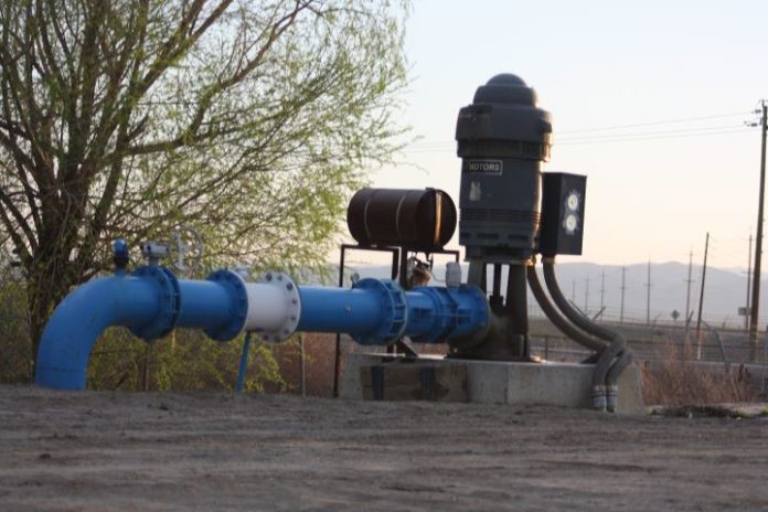
Water wells are not monitoring wells. They are not designed, nor built as monitoring wells. Monitoring wells are designed and built to provide discrete information, such as the depth to water in a specific aquifer, at a specific depth. Water wells on the other hand are designed and built to obtain as much water as possible. In the case of public water supply, the additional criteria of potable water exists, however the objective is a large quantity of potable water. Irrigation wells have no potable water criteria and water quality is a crop-growth criterion – after quantity of water.
There is great risk to relying on data generated from water supply wells being used as monitoring wells.
A water supply well’s depth-to-water may be a combination of water levels from different aquifers utilized by the well. The water quality in a supply well may be a combination of water chemistries from these different aquifers. In both cases these combined values may misrepresent the actual conditions in the subsurface.
Potable supply wells are often located within municipal boundaries and as a rule have more data related to their presence. However, being clustered close together they cannot offer the geographic spread of a “monitoring network” large enough size to meet the demands a Groundwater Sustainability Plan (GSP) requires. The only recourse is to use irrigation wells, which are dispersed throughout the areas being assessed, on regular spacings, making them ideal geographically for the GSP monitoring networks.
Unfortunately, irrigation wells (as mentioned) are designed and built to maximize flow rates and as such built to obtain water from multiple aquifers. Furthermore, irrigation wells are often pumped the longest, at the highest rates, and receive little to no routine maintenance. The result is wells may be damaged, plugged, or encrusted to the point combined water levels and water chemistries are even more convoluted.
The increased complexity merely serves to decrease the reliability of the data from these wells. One example; a measure of well performance called the “specific capacity” (flow divided by drawdown) is sometimes used in modeling efforts to assume an aquifer’s hydraulic value (transmissivity) that is important to modeling how an aquifer will respond to pumping. However, if the well is inefficient because of plugging, blockage, damage or simply lack of maintenance the specific capacity is artificially different and the transmissivity values incorrect. As such the model results are potentially questionable.
So, what does this mean for a property owner, a well owner, involved in the agricultural economy? If the monitoring network data serving the GSP for our Groundwater Sustainability Agency is based on irrigation wells it is possible the data collected from those wells may misrepresent the aquifer’s condition.
Some of the possible concerns you should consider are:
- Water levels in my area may be inaccurate due to network wells are misrepresenting actual conditions because of impaired well conditions.
- The actual and the modeled performance of “typical wells” in my area may be based on a network well providing incorrect data.
- Recharge may appear less effective in my area because the network wells are misrepresenting changes in aquifer water levels.
The list can go on. In summary, agriculture must speak for itself regarding adequate representation in the “court of data” especially with respect to GSP monitoring networks.
I recommend having serious discussions with professionals knowledgeable in the relationship between wells and aquifers regarding the accuracy of data from the wells in your GSP monitoring network. Ask the tough questions now, find the answers and avoid the tough SGMA battle in the future.
Chris Johnson, PG CHg, hydrogeologist, founder and President of Aegis Groundwater Consulting, LLC can take much of the mystery out of what flows under our feet. Johnson’s curiosity and intellect lead him to earn both bachelor’s and master’s degrees in geology from California State University, Fresno. Johnson was born in Little Rock, Arkansas and his first professional job was with the California Department of Water Resources, but he soon went to the private side; working 24-years for Kleinfelder engineering firm where he retired as the National Director of Groundwater Services in 2008. He also founded Aegis Groundwater Consulting that same year. Aegis provides private consulting to agricultural, municipal and industrial clients.
DISCLAIMER OF RESPONSIBILITY; Waterwrights strives to provide his clients with the most complete, up-to-date, and accurate information available. Nevertheless, Waterwrights does not serve as a guarantor of the accuracy or completeness of the information provided, and specifically disclaims any and all responsibility for information that is not accurate, up-to-date, or complete. Waterwrights’ clients therefore rely on the accuracy, completeness and timeliness of information from Waterwrights entirely at their own risk. The opinions expressed in this report are those of the author and do not represent any advertisers or third parties.
ALL RIGHTS RESERVED. Copyright 2020 by Don A. Wright


